By Tatyana Hopkins
A new tool will help visitors to Washington, D.C., discover the historic and contemporary landmarks of those who inhabited the city’s land before its development as the nation’s capital.
“Guide to Indigenous D.C.” is a free mobile app developed by the George Washington University’s AT&T Center for Indigenous Politics and Policy (AT&T CIPP) in collaboration with the American Indian Alaska Native Tourism Association.
The project, funded by the American Indian College Fund, Native Americans in Philanthropy and the Minneapolis Foundation, includes a walking tour map, directions and guide that highlight the contributions of Native Americans to the city.
Elizabeth Rule, assistant director of AT&T CIPP, designed and developed the app. She said D.C. is full of landmarks with historical, political and cultural connections to Native Americans.
“D.C. was built on Indian land and indigenous homeland, and there is a very strong history and ongoing contemporary indigenous presence in this city,” said Dr. Rule, who is a member of the Chickasaw Nation.
The app, which is available for free download for iOS devices, currently features a map of 17 locations, including learning institutions and sites of important events.
“Some sites are very visible and very prominent, such as the National Museum of the American Indian,” Dr. Rule said. “But as I talked to people as I was building the list of sites to be included, it kept growing.”
One of the lesser-known sites included on the list is the Dumbarton Bridge, also known as the Q Street and Buffalo Bridge, which connects Q Street Northwest across Rock Creek Park.
Along with a buffalo theme, the bridge’s arches feature 56 identical busts of Sioux Chief Kicking Bear, an organizer, warrior and religious leader, who was one of three delegates to take grievances to the Bureau of Indian Affairs in Washington, D.C., about local law enforcement’s interference with Lakota trade practices in 1896.
“That is something just walking by the bridge that you wouldn’t notice,” Dr. Rule said. “But he was a champion for his people.”
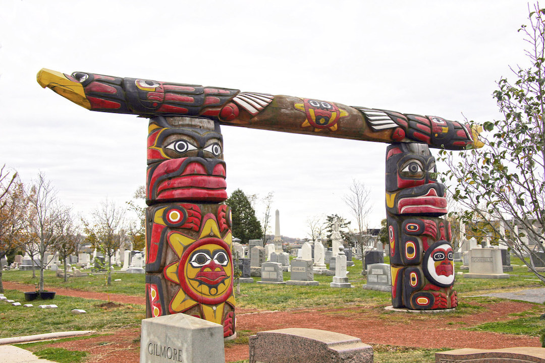
Other destinations include the Embassy of Tribal Nations, Liberty and Freedom Lummi Totem Poles at the Congressional Cemetery, and the site of the Cowboy and Indian Alliance camp, which was erected in front of the U.S. Capitol during the 2014 protests of the Keystone XL oil pipeline. Dr. Rule developed the app’s list of designations by consulting with scholars, local tribal members and historians including George Mason University professor C. Joseph Genetin-Pilawa and Smithsonian historian Gabrielle Tayac.
GW plans to use the app as a teaching tool for its Native American Political Leadership and Inspire Pre-College programs, which provide scholarships to American Indian, Alaska Native and Native Hawaiian students to study public policy and politics at GW.
“We wanted to develop this app for Native youth to make sure that they feel empowered by the things that have happened here and by being here learning about how Native policy is made and how decisions that are being made every day in Washington, D.C., can affect their daily lives in their communities,” said AT&T CIPP Director Wendy Helgemo.
Ms. Helgemo said making a historical connection to the program’s policy training is important in light of a recent study that revealed that 62 percent of Americans outside of Indian country reported being unacquainted with Native Americans, among other findings.
“Anywhere you go in the United States, you're on indigenous land,” she said. “As an indigenous center housed at GW, it's part of our responsibility to tell these stories and to acknowledge the people whose lands we are on and those who have come before us.”


