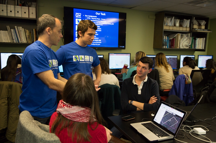
Junior Anna Berger has never stepped foot in Zimbabwe’s capital of Harare. She’s never seen its streets or its densely populated neighborhoods. But on Friday night, she sat in the Old Main Spatial Analysis Lab with about 80 George Washington University student volunteers, mapping out the African metropolis’s exact roads and buildings on her computer.
Although GW is more than 8,700 miles from Africa, mapping Harare was possible through OpenStreetMap (OSM), a digital platform that provides outlines of cities in remote areas using satellite photography and geospatial technology. Users examine aerial images to determine the layout of specified regions, and they label details to create digital maps. For example, you might observe in a photo that a small oblong figure actually represents a house; a long rectangle might clearly be a road. It only takes minutes to learn to use OSM, and people can map from wherever they are in the world.
“I remember when the Malaysian airplane went missing, people could use aerial images to try and search for it. It’s cool that you can help, even if you’re doing it from a remote place,” Ms. Berger said.
Detailed maps are necessary in developing countries, where a reliable lay of the land frequently does not exist. That’s why the American Red Cross has spearheaded the Missing Maps Project, an initiative that aims to bridge gaps and provide complete outlines of countries so that nonprofit and international organizations can better respond to crises in vulnerable regions.
On Friday night, as part of Geography Awareness Week, the GW community took the Missing Maps Project into its own hands during a Mapathon organized by the student-run Humanitarian Mapping Society. The goal of the event was to focus not only on Harare, but also Ebola-plagued Guinea, where maps may help public health officials identify transportation routes, gathering spots and areas to deliver supplies.

Friday's Mapathon was put together by the student organization, Humanitarian Mapping Society.
“The mapping work isn’t taxing—you just need a lot of people to get it done quickly. It’s a ‘many hands, light work’ kind of thing,” said second-year graduate student and HMS President Kelsey Nyland, B.A. ‘13.
Because OSM is an open-source platform, the data coded within the program can be accessed by anyone. Individuals and businesses alike can use the maps, and people on the ground in each country can even add to them with more detail, Ms. Nyland said.
She’s a physical geographer who conducts climate change research in Arctic permafrost. After participating in several mapping projects at GW, she paired up with other students to form HMS this semester. Ms. Nyland also volunteers at the Red Cross, where she first heard about efforts to map Guinea and Harare. A Mapathon to get GW involved in those two parts of Africa seemed like a good first event for the new organization, so Ms. Nyland invited students, staff and faculty to Old Main to enjoy pizza and learn to use OSM.
Ms. Nyland received support from several geography professors, including Nuala Cowan, who has led multiple Mapathons in her classes. Last year, she guided approximately 90 students as they built maps for the disaster-prone city of Kathmandu.

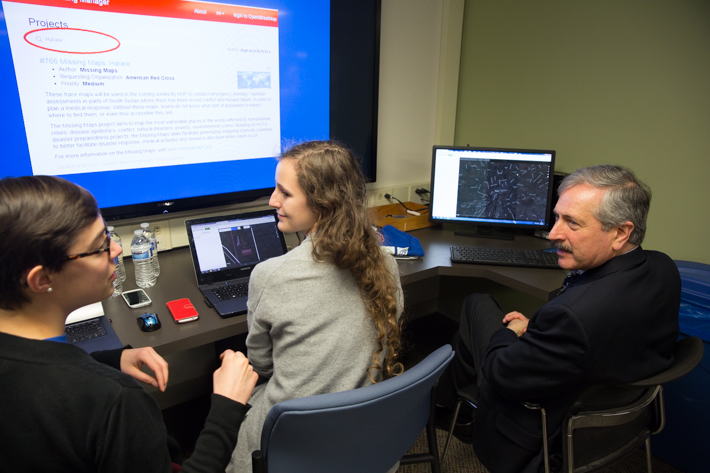
Provost Steven Lerman learns to use OSM technology with students.
Members of the State Department, representatives from the Red Cross and GW Provost Steven Lerman stopped by to lend a hand at the event. Dr. Lerman, who is also a transportation engineer, gave quick remarks to students, thanking them for their volunteer mapping work.
“This technology has really transformed how we can think about spatial identification and tracking and certainly about how we can think about providing information that can help humanitarian efforts,” he said.
Ms. Nyland emphasized that when students participate in Mapathons, they’re not only helping worthy causes, but they are also picking up marketable and easy-to-learn mapping skills. Ms. Berger didn’t know how to use OSM before Friday, but senior Dominic Homac provided her with a quick tutorial of the platform. Within minutes, she was mapping alongside more experienced users.
“This shows how easy it is to get people involved in humanitarian efforts through technology and how people can really help with a cause,” Mr. Homac said.
Interested in learning to use OSM to help with humanitarian efforts? Join the Humanitarian Mapping Society for their last meeting of the semester on Dec. 4.


