
Hours after a 7.8-magnitude earthquake hit Nepal, George Washington University junior Eleanor Davis woke up to a cellphone alert from OpenStreetMap (OSM), a free open-source, web-based hub for global mapping.
Through OSM, thousands of people around the world use aerial images and geospatial technology to create editable maps on the web with the goal of mapping less-traveled areas, such as slums and rural parts of developing countries.
In a global crisis, these maps become essential to relief efforts, which is why Ms. Davis—president-elect of the student-run GW Humanitarian Mapping Society (GW HMS)—jumped into action.
“I immediately sent out a message that reached more than 1,000 people on Facebook, Twitter and our list serve. We had an overwhelming response,” Ms. Davis said. “It felt amazing to be able to contribute and know that even if you can’t fly into Kathmandu, you can do something to help.”
More than 7,000 deaths and more than 14,000 injuries have been attributed to the earthquake, which flattened parts of Kathmandu and caused a ripple effect of devastation, according to the Red Cross.
Digital mapping begins with an overlay of a grid over an aerial satellite image of a region, dividing it into squares. Individual mappers are then assigned a square to map—identifying buildings, roads and other landmarks—through the Humanitarian OSM Tasking Manager, Ms. Davis said.
By Friday—just five days after the April 25 earthquake—more than 10 different mapping tasks of Nepal were completed by thousands of participants.
“There are still new [mapping] tasks every day, but now it’s more of a ‘second sweep,’” said senior Kendra Speak, the GW HMS event coordinator. “The first round of mapping is focused on quality but also immediacy. Now that the basic maps are finished, local mappers in Nepal can go in and correct inaccuracies and provide more details.”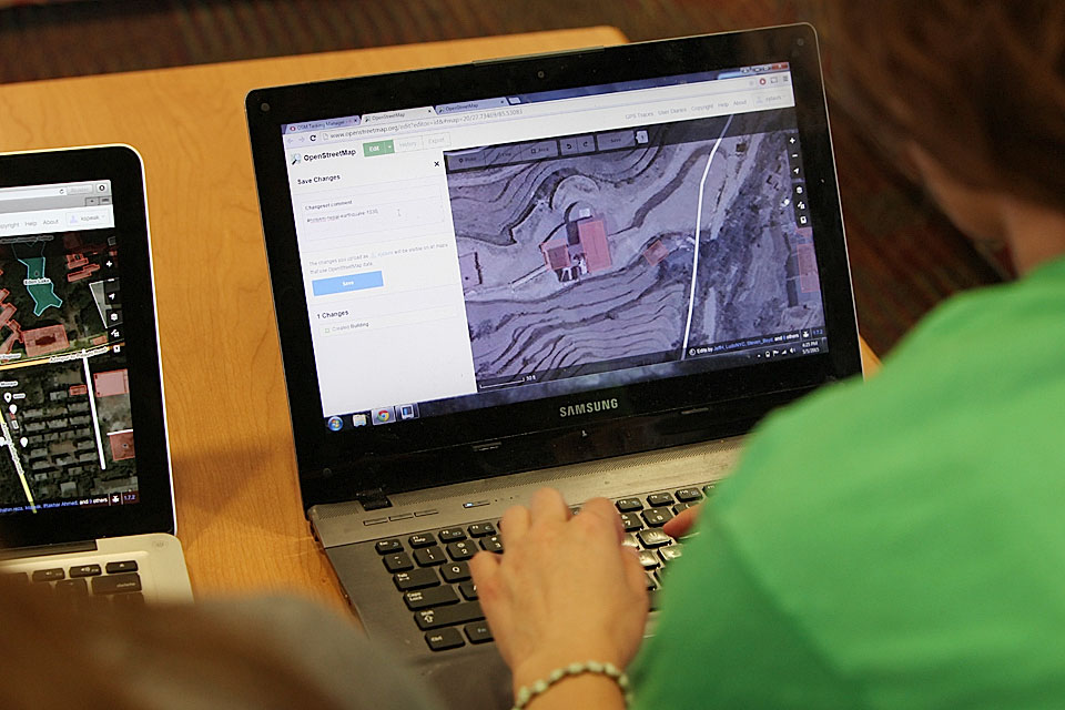
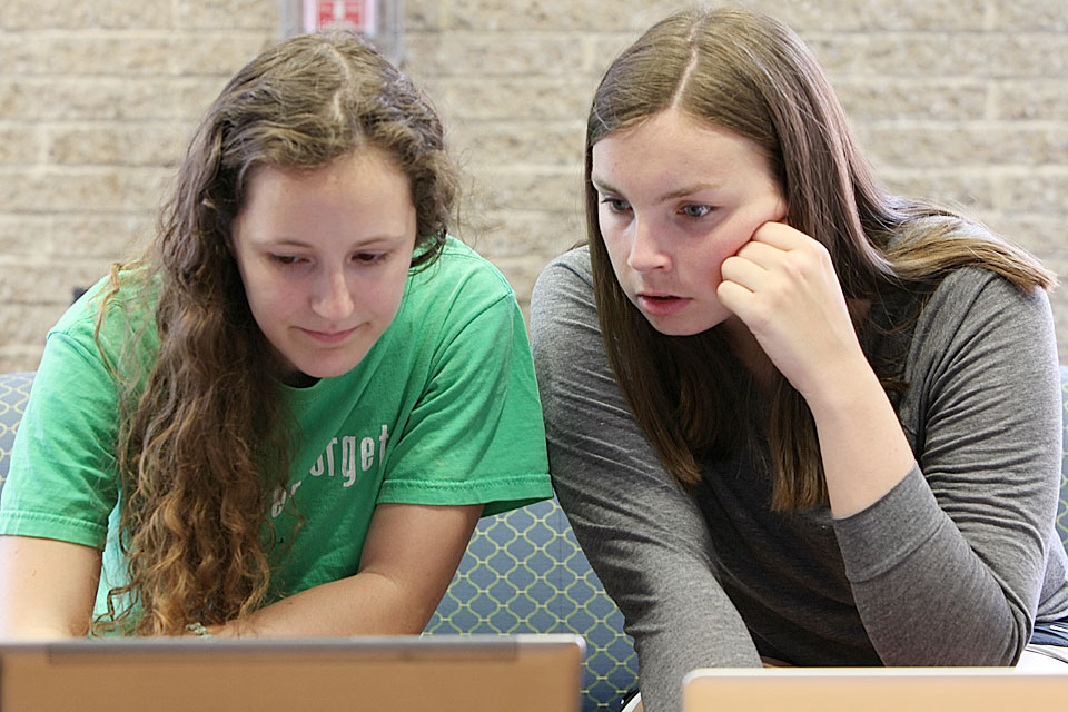
Students in the GW Humanitarian Mapping Society were among the thousands of people around the world who offered a helping hand to relief workers in Nepal by creating digital maps of hard to navigate areas on OpenStreetMap. (Rob Stewart/GW Today)
The first “task” sent out by OSM was to map roads to help relief workers from the Red Cross, U.S. Agency for International Development (USAID) and other organizations navigate areas outside of the city, Ms. Davis said.
Red Cross Geographical Information Systems (GIS) Analyst Samuel Estabrook said that although Kathmandu was close to the epicenter of the earthquake, it hit west of the city.
Concerns in the region include road closures due to landslides and building collapses.
“If we send responders to a town, and they know there are 100 buildings in the town from the map, but they only see four buildings standing, they can better understand the effect of the disaster,” Mr. Estabrook said. “Otherwise, they’d have to try and to determine the number of buildings based on the rubble.”
He added that many of Nepal’s most affected areas already were well mapped because of earlier OSM efforts. Nepal has long been considered at-risk for an earthquake of this magnitude.
These maps are valuable information for responders because “any data is better than no data,” Mr. Estabrook said.
“These methods really allow us to be more prepared. You never know what decisions you’ll have to make on the ground, but we’re hoping these maps contribute to more data-driven decisions,” Mr. Estabrook said.
GIS students in GW’s Department of Geography worked in collaboration with USAID, the World Bank and Kathmandu Living Labs to map Kathmandu at a three-hour “mapathon” event in 2013.
Nuala Cowan, an assistant professor in the Department of Geography and director of the GIS graduate certificate program, oversaw the project.
Dr. Cowan and her department colleagues have been supporting events for GW’s open-source mapping community for about five years. With her direction, students have worked with OSM to map Indonesia, Bangladesh, Zimbabwe and other areas at “mapathon” events.
GW HMS launched in fall 2014, following overwhelming interest in mapping from students, Ms. Speak said.
The organization meets monthly to practice mapping skills and hear from relief workers about how mapping helps them deploy resources more efficiently. GW HMS also hosts a “mapathon” each semester.
“The motivation of our members is mostly being able to help people,” Ms. Speak said. “Many of our members are new to mapping, but they are passionate about the help they are providing to relief organizations.”
Michael Crino, deputy director of the USAID GeoCenter, applauded GW HMS’ efforts.
He said that when the USAID Disaster Assistance Response team arrived in Nepal two days after the earthquake, they were able to supplement their GPS data with OSM mapping data.
“What the GW students have done is great,” Mr. Crino said. “They are connected to the OSM community, and that’s awesome because they can introduce other students to mapping.”
Looking ahead, both Mr. Crino and Mr. Estabrook said that relief organizations are working to analyze open-source maps of Nepal created before and after the earthquake to better inform their disaster preparedness and relief programs.
“Using open-source remote mapping data is still new to humanitarians,” Mr. Estabrook said. “Our old methods ring true to us and assessment is ongoing, but open-source mapping data seems to be a starting point for a new way to make data-driven decisions in the field.”