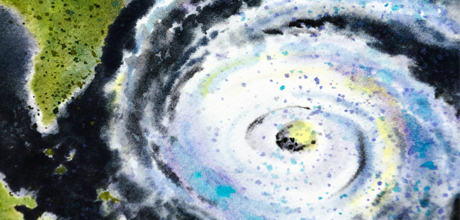
What started last week as a tropical storm in the Caribbean quickly became a hurricane of historic proportions.
Even before it made landfall along the East Coast, Hurricane Sandy had already flooded beach towns along the Eastern seaboard, and shut down mass transit in major cities, including New York and Washington, D.C. Millions are still without power, and some regions saw several feet of snow. There are 51 reported deaths in the United States as a result of the hurricane.
Although the storm was recently reclassified by the National Hurricane Center as “post-tropical,” it is still winding down, leaving behind high winds and cold air in southern New England, the Ohio Valley and the Great Lakes.
Associate Professor of Geography Ryan Engstrom spoke with George Washington Today about how Hurricane Sandy was created and where it falls in the history books.
Q: Hurricane Sandy has been described as a hybrid storm. What does this mean?
A: Sandy was a hurricane that merged with a low pressure system that was moving across the United States. These low pressure systems are usually called mid-latitude cyclones and move from west to east across the United States and bring us much of the day-to-day variations that we have in weather (e.g., rain, snow, etc.). In addition, there was high pressure system over part of the Atlantic that blocked the storm from moving out over the ocean as hurricanes generally do. This merging of storms is why it was called a hybrid storm. For all of these conditions to happen together is very unlikely, this is why this was such a rare storm.
Q: How was Sandy created?
A: Sandy started out as a low pressure system in the southern part of the Caribbean. It moved in a northerly direction along the U.S. coast. As the low pressure system was coming across the U.S. from the west, it caused Sandy to turn toward the East Coast. This low pressure, plus a blocking high pressure system over the Atlantic, caused Sandy and the low pressure system to merge. This typically does not happen because the normal wind patterns blow hurricanes away from the coast and out to sea in areas this far north.
Q: How does Sandy compare historically to other storms?
A: Historically, Sandy was one of the largest systems ever in terms of wind field size. This means that the high winds were spread out over a very large area. It was amazing how far out the tropical storm force winds were reaching. Also, the pressure at the center was one of the lowest ever recorded for a storm north of Cape Hatteras. Because winds always blow from areas of higher pressure to areas of lower pressure, the lower the pressure, the greater the wind speeds generally are.
In terms of history, the wind speeds were not that great; however, the sheer size of the areas that were covered by high winds combined with the large number of people that the storm impacted was unprecedented. Finally, the storm reached the coastline in many areas about the same time as a very high tide due to the full moon. This greatly impacted the height of the storm surge.
Q: What conditions made Sandy worse?
A: The condition that made Sandy worse was its interaction with the low pressure system. This interaction spread out the winds and brought the hurricane on shore. Also, the Hurricane Sandy's arrival during a very high tide was incredibly unusual.
Q: Where you think the hurricane hit the hardest and why?
A: This is a difficult question to answer. From the news standpoint it appears to be New York City. The damage in New York City was primarily due to storm surge. The high storm surge in New York City was caused by a combination of factors: the tremendously large area of the winds from Sandy, the geography of the coastline, the direction the winds were blowing, the storm hitting when there were very high tides, and the fact that a lot of the city is not that far above sea level. However, other areas experienced more wind and rain than New York City.
Q: Were predictions of the hurricane's impact on our area accurate?
A: I think they were. The predictions were for high winds and heavy rain. That is what we got. The number of power outages that we had may have been less than many people anticipated, but this is difficult to predict due to other factors not attributed to storm (number of trees staying upright, strength of the utility infrastructure, etc.). Overall, this was very, very unusual storm and trying to make a prediction about something with little historical precedence is difficult. I still find it amazing that last Wednesday I put up an image of a model prediction of the storm in my physical geography class and this model prediction was very close to what actually happened.


